Search
The Search section of the NUVIEW Platform lets you discover and explore a catalog of geospatial datasets by area, date range, and cloud cover — including satellite imagery, LiDAR, elevation models, and more.
Click Search in the left navigation bar to open the search interface.
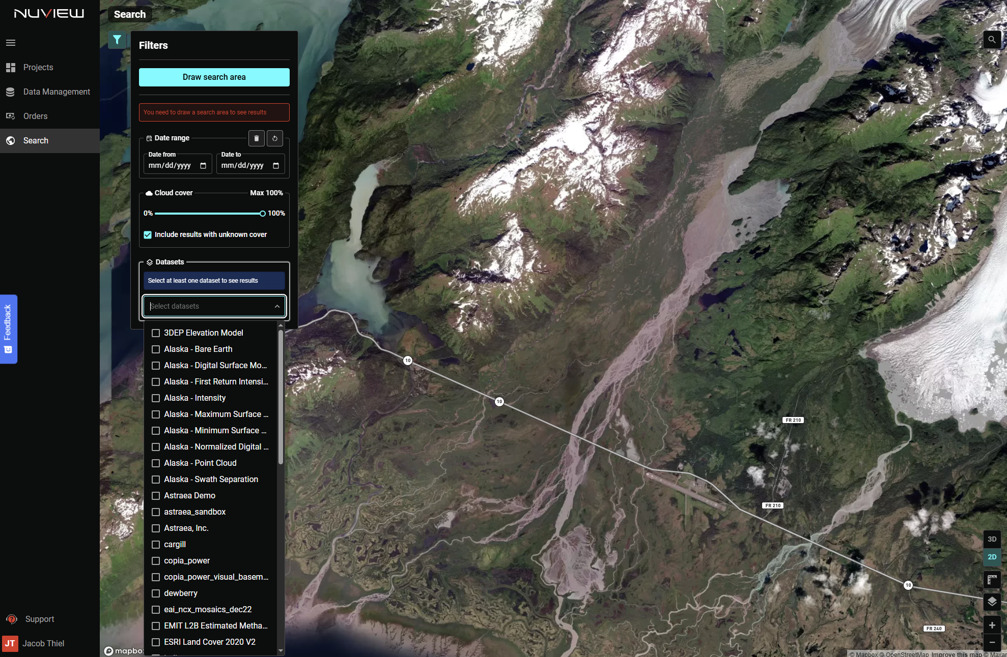
Step 1: Draw a search area
Click Draw search area at the top of the Filters panel, then click and drag on the map to define your Area of Interest (AOI). You must draw a search area and select one or more datasets before results will appear.
Once drawn, a red bounding box appears on the map and results begin loading. A Clear search box link appears below the button to remove the AOI and reset results.
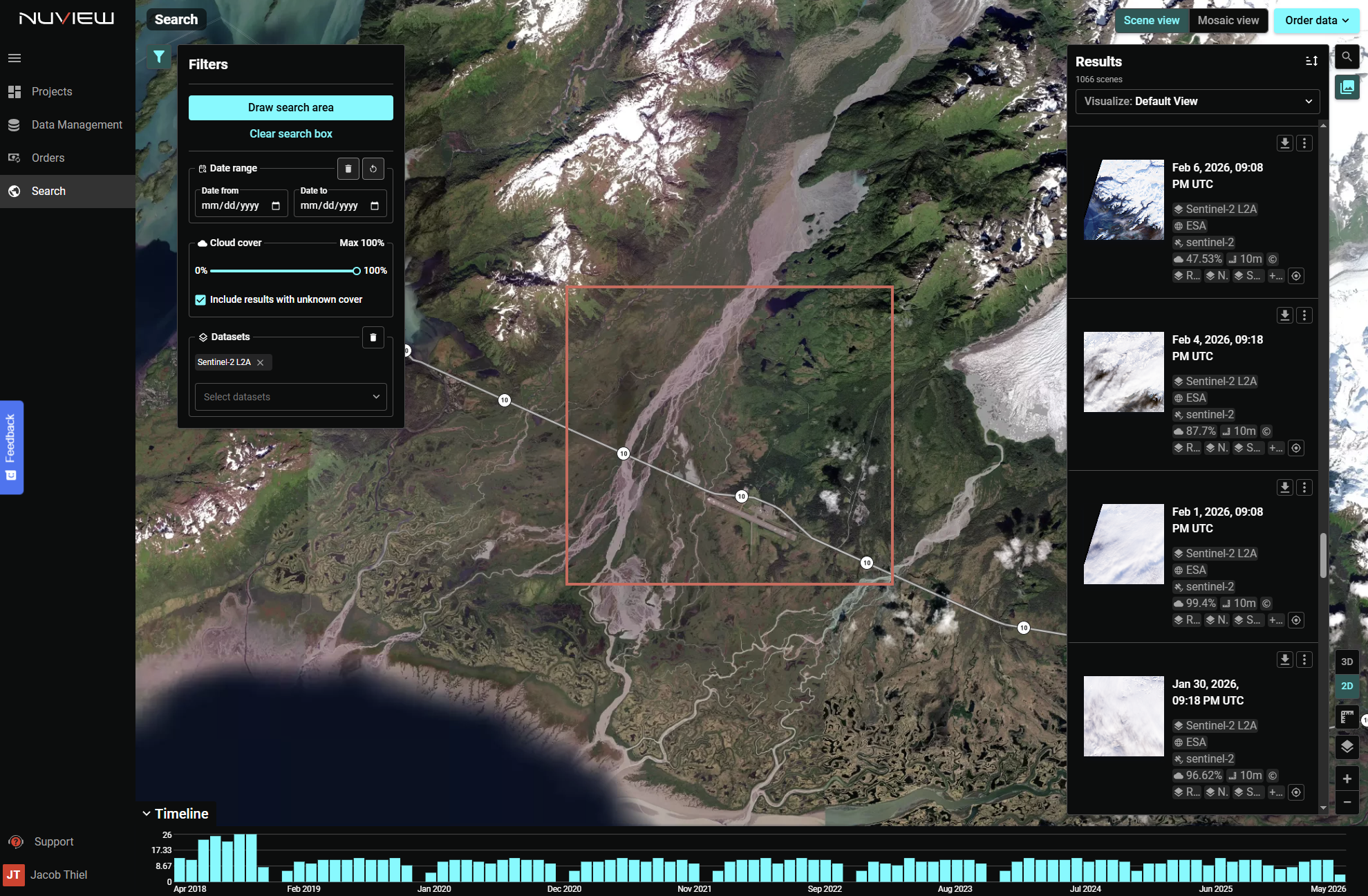
Step 2: Set filters
Refine your search using the controls in the Filters panel:
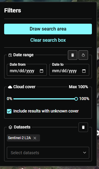
- Date range — Set a Date from and Date to to limit results to a specific time period.
- Cloud cover — Slide to set the maximum acceptable cloud cover percentage. Enable Include results with unknown cover to surface datasets that don't report cloud cover metadata.
Step 3: Select a dataset
Open the Datasets dropdown to choose which data catalog to search. The NUVIEW Platform includes a broad catalog of public and commercial datasets:
Elevation & LiDAR
| Dataset | Description |
|---|---|
| 3DEP Elevation Model | USGS 3D Elevation Program — nationwide DEM coverage |
| Alaska - Bare Earth | LiDAR-derived bare earth surface for Alaska |
| Alaska - Digital Surface Model | Full surface model including vegetation and structures |
| Alaska - First Return Intensity | Intensity values from first LiDAR returns |
| Alaska - Intensity | LiDAR intensity data |
| Alaska - Maximum Surface | Maximum surface elevation derived from LiDAR |
| Alaska - Minimum Surface | Minimum surface elevation derived from LiDAR |
| Alaska - Normalized Digital Surface Model | Canopy height model (surface minus bare earth) |
| Alaska - Point Cloud | Raw LiDAR point cloud data |
| Alaska - Swath Separation | LiDAR swath separation diagnostic layer |
Satellite Imagery
| Dataset | Description |
|---|---|
| Landsat | USGS/NASA multispectral imagery, 30m resolution, global coverage since 1972 |
| Sentinel-2 | ESA multispectral imagery, 10m resolution, global coverage |
| NAIP | National Agriculture Imagery Program — high-resolution aerial imagery for the contiguous US |
| EMIT L2B Estimated Methane | NASA EMIT methane plume estimates from imaging spectroscopy |
| ESRI Land Cover 2020 V2 | Global land cover classification at 10m resolution |
Additional datasets
Additional public, commercial, and partner datasets are available in the dropdown depending on your subscription. Contact support@nuview.space to request access to specific collections.
Step 4: Browse results
Once a search area and dataset are selected, the Results panel opens on the right showing the total scene count and thumbnail previews. Each result shows the collection date, provider, cloud cover percentage, and resolution.
- Hover over a thumbnail to highlight its footprint on the map
- Click a footprint on the map to isolate that scene
- Click a thumbnail to load and display that image
Use the Scene view and Mosaic view tabs in the top-right to switch between browsing individual scenes and viewing a mosaicked composite. Click Order data to place an order directly from the search results.
The Timeline histogram at the bottom shows imagery availability over time for your AOI — use it to identify periods of dense or sparse coverage before selecting a date range.
Step 5: Refine and compare
Continue adjusting filters and datasets to narrow results. Use the A|B side-by-side comparison to compare two images from different dates, or the histogram to see temporal coverage density over your AOI.