Convert satellite image formats
Often users need to get a "regular image" from a satellite image — this means converting a .tif or .jp2 file into a .jpeg or .png file. This can be done using QGIS. If you have not installed QGIS on your computer, you can download it freely here.
Download your image from the NUVIEW Platform
- Navigate to the site or search result containing the imagery you want to export.
- In the Results panel, locate the scene you want to download.
- Click the Download icon on the scene to open the download options.
- Select the Visual or RGB asset from the list.
- Download the file to your computer.
For a full walkthrough of downloading raw imagery, see Download raw imagery.
Convert image to PNG in QGIS
-
Once the asset is downloaded, open it in QGIS.
-
Zoom to the area you want to show in your converted image.
-
Select Project > Import/Export > Export Map to Image... from the menu.
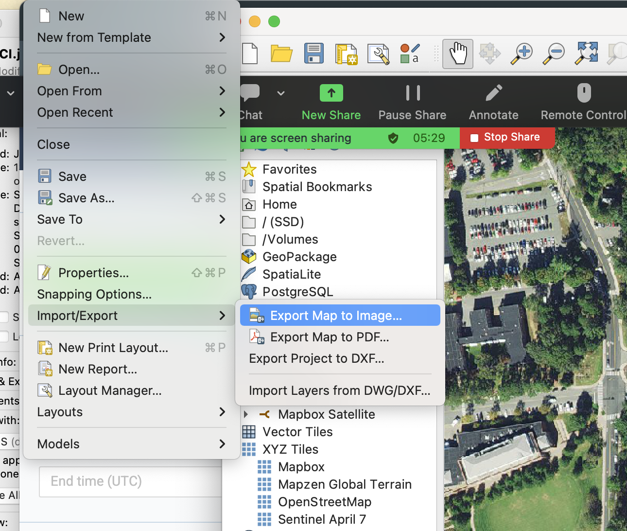
-
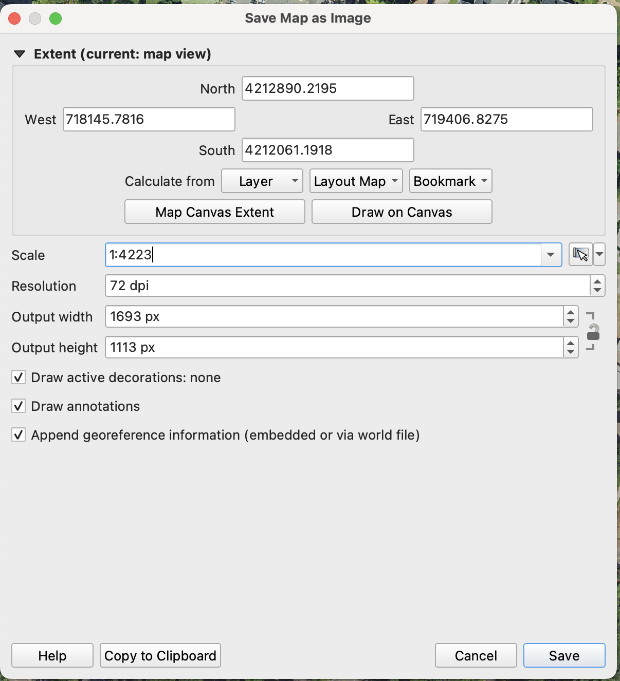
Press Map Canvas Extent to capture the entire area shown in the map view, or press Draw on Canvas to manually select an area to export.
-
Set the resolution to the desired value. The pixel count will be shown below — be cautious, as a very high resolution can create a very large file. It is typically good to start with 72 DPI and see if the output is sufficient for your use case.
-
Press Save and choose the desired directory. The default format is PNG, but you can also select JPEG.
-
Inspect the output image.