Download raw imagery
The NUVIEW Platform lets you download LiDAR and raster data as a scene or as a single mosaicked file clipped to your AOI — eliminating the need to download and stitch individual tiles together manually.
Download Project Scenes
From the Projects tab:
- Navigate to Projects using the left sidebar.
- Open a site from the site menu.
- Select a scene from the Timeline.
- Select the Download icon in the top right corner of the map.
- Configure your download.
- The file will be prepared and downloaded to your machine.
Download Mosaic Asset Bundle
When viewing data in Mosaic view on the Search tab, the Results panel on the right includes a Download mosaic asset bundle button next to each scene entry.
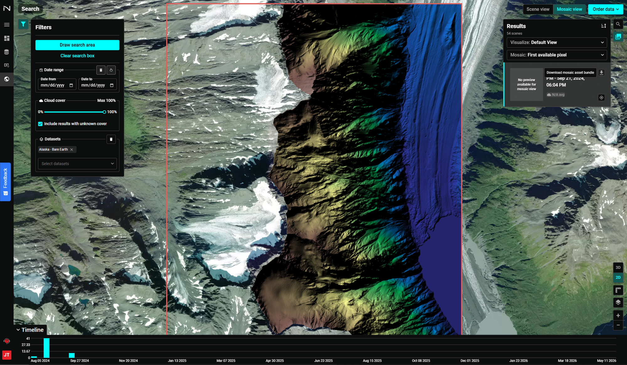
Clicking the download icon delivers the entire dataset mosaicked and clipped to your AOI boundary as a single file. This is the recommended way to export LiDAR and raster data from the platform.
Why use the mosaic download?
- No tile stitching required — The platform handles mosaicking server-side and delivers a single, ready-to-use file
- Clipped to your AOI — You receive only the data within your area of interest, not full scene extents
- Works for LiDAR and raster — Supports point cloud, bare earth, elevation, and imagery products
How to Download
From the Search tab:
- Navigate to Search using the left sidebar.
- Click Draw search area in the Filters panel and draw your AOI on the map.
- Select your dataset (e.g., Alaska - Bare Earth, NUVIEW LiDAR) under Datasets.
- Switch to Mosaic view using the toggle in the top-right corner.
- In the Results panel on the right, click the download icon next to the scene entry labeled Download mosaic asset bundle.
- The file will be prepared and downloaded to your machine.
Download Ordered Imagery
For high-resolution imagery you have ordered through the platform:
- Navigate to the Orders section using the left sidebar.
- Locate your completed order.
- Click the download icon next to the order to retrieve the asset.
Using Downloaded Data in GIS Applications
Once downloaded, your data can be loaded directly into any GIS tool that supports standard raster or point cloud formats:
- QGIS — See Use data in QGIS
- ArcGIS — See Use data in ArcGIS
For questions about downloads or file formats, contact support@nuview.space.